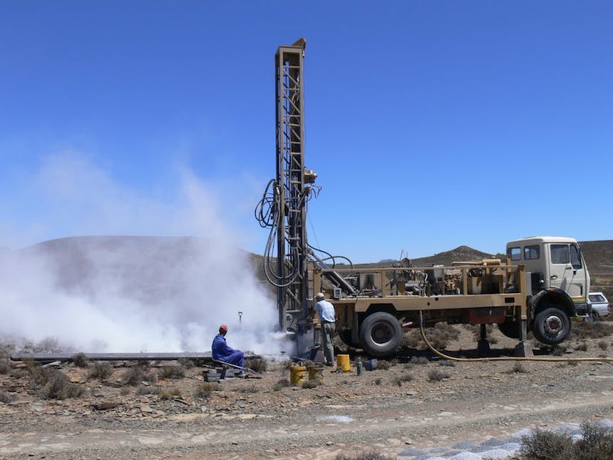
The South African government has made a firm commitment to proceed with unconventional gas exploration using fracking. During fracking a mixture of water, sand and chemicals is pumped under high pressure into a deep well to fracture the rock and release “tight” gas that is not easily released by the rock. Speculative estimates of the potential gas resource in the country’s Karoo basin range from 13 to 390 trillion cubic feet of gas, with the lowest estimate being the most realistic.
The extraction of shale gas is an attractive option. It could reduce South Africa’s huge reliance on coal for energy.
But there are also uncertainties around the impact of shale gas extraction. That’s why the Academy of Science investigated South Africa’s technical readiness for shale gas development. It assessed the status of available information and technologies that can support the development of the shale gas industry. The government also commissioned the strategic environmental assessment for shale gas development.
One major concern from fracking is that groundwater will be affected in the shale gas extraction process. But a groundwater vulnerability map could help assess these risks. It also has the potential to help government decide which regions can be more safely fracked to limit damage to groundwater resources.
Groundwater damage
Groundwater only contributes about 13% of the total water supply of South Africa, but it is an important strategic water source. Two thirds of South Africa’s surface area and more than 300 towns depend largely on groundwater for drinking water.
Unconventional oil and gas extraction often has an impact on groundwater. Some of these include aquifer damage. An aquifer is an underground layer of water-bearing rock from which groundwater can be extracted using a borehole. During oil and gas extraction, an aquifer can experience dewatering, deformation, and contamination.
In some cases, the damage from contamination can be irreversible, such as when aquifer contamination can’t be physically cleaned or rehabilitation is too expensive. Physical cleanup may be impossible, for instance, when certain organic contaminants cannot be effectively removed. In the US, hazardous waste cleanup sites present a technical and institutional challenge at more than 126 000 contaminated locations. Various organic compounds are also used in fracking fluids and therefore represent similar risks to groundwater resources.
Both research reports on shale gas extraction found that it could have an impact on South African groundwater resources. One of the reports found that there were no extra groundwater resources available and that fracking operations would impact existing ones. This report also found that shallow groundwater resources in these water scarce areas may be contaminated by fracking operations.
That’s where the groundwater vulnerability map comes in. It gives the location of sites where the groundwater resource is at risk due to a potentially damaging event linked to fracking, which could cause pollution or destruction of this resource.
A groundwater vulnerability map
The groundwater vulnerability map for unconventional oil and gas extraction shows the areas where groundwater is at risk from unconventional oil and gas extraction. The map is classified from very low to very high vulnerability. Areas with high vulnerability should not be used for exploration and extraction.
But it does not mean that areas with low vulnerability is a free for all and that oil and gas extraction can go ahead freely. The map also shows the location of geological structures where groundwater is more vulnerable to oil and gas extraction, because contamination from for instance spillages can enter the groundwater easier at these locations. Protection zones have been drawn around these vulnerable geological structures and no oil and gas development activities should occur within these zones.
The interactive map has already helped researchers in performing the strategic environmental assessment for shale gas development. It could also be useful assessing water use license applications, oil and gas extraction permit applications and environmental impact assessments. The map presents the relevant groundwater vulnerability information in a central location and in a comprehensible manner.
The interactive vulnerability map will also help regulators with risk assessment. It will ensure consistent interpretations of groundwater vulnerability by different users, if they all use one standard map. And it will enhance the transfer of scientific information to government, consultants and academia.
The map may also be used to guide policy development for unconventional oil and gas extraction for fracking in South Africa. It may assist with the development of effective oil and gas extraction regulations to ensure sustainable development.
Lessons for South Africa
Most international vulnerability maps for oil and gas extraction have been produced after fracking operations have already started. They don’t represent baseline maps which show areas that are vulnerable to fracking before the process starts. This is because when fracking was first used to extract oil and gas, information on its possible impact on natural resources, was not yet available.
The value of baseline vulnerability maps was therefore not yet understood. Baseline vulnerability maps could however reduce uncertainty in understanding the risks to humans and wildlife from oil and gas extraction and could be used in adaptive management. It could also present an impartial scientific base for resource management during extraction of oil and gas resources.
Countries that are planning to go ahead with fracking and shale gas extraction have a unique opportunity to address data needs and perform crucial baseline vulnerability mapping before extraction starts.
Such a map should also be linked to an active public access database, much like the Fracktracker database. This is an interactive map that shows information on where extraction takes place by showing well sites, gas pipelines and shale gas deposit localities. And, where available, it shares information on volumes of water and chemicals used and wastewater recovered. Such a map shows information in real time and will lessen data gaps. It will enhance transparency and access to information. This would enable government to better protect natural resources during extraction and could enhance citizen stewardship.

